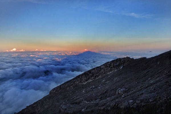
A marked increase in the number of earthquakes happening below Mount Agung volcano in eastern Bali, Indonesia, over the past few weeks has authorities keeping a close watch on the situation.
The latest alert issued by the national and local government agencies now forbids climbing of the mountain and orders evacuations within 7.5km of the summit.
Although infrequent, eruptions of Mt Agung have been among the largest of the past 100 years of global volcanic activity. More than 1,000 people died during the last eruption in 1963.
Read more: Ancient volcanic eruptions disrupted Earth’s thermostat, creating a ‘Snowball’ planet
Our ability to predict eruptions has improved dramatically since this last event, so we can hope such a death toll will not occur again.
Mt Agung is one of many similar volcanoes in Indonesia and the Ring of Fire surrounding the Pacific and eastern Indian oceans. But during its sporadic eruptions, Agung has been one of the most prominent injectors of volcanic ash and sulfur dioxide into the atmosphere.
This type of activity can have effects that are more widely felt than by just the population of Bali.
The 1963-64 eruption
Mt Agung is a large volcano with a peak 3,142 metres above sea level. The mountain dominates the landscape of eastern Bali.
The 1963 eruption was preceded by earthquakes. Then in February of that year, lava began to flow from the summit crater, eventually extending for about 7km down the northern slope. Small explosions of volcanic ash accompanied this activity.
The intensity of explosive activity developed rapidly leading to a major explosion on March 17. Simultaneously, eruption of terrain-hugging debris flows of red-hot lava blocks, ash and gases (pyroclast flows or nuées ardentes), tore down the flanks devastating large areas on the north and south sides of the volcano.
Heavy rainfall on the fragmental volcanic materials triggered flows of mud and boulders to additional flanks of the mountain. These debris flows are called lahars, an Indonesian word that has been adopted globally. Another major explosive event occurred two months later from Agung with similar physical consequences.
What is happening now?
Based on the activity that preceded the last eruptions of Mt Agung in 1963, there is growing concern that the volcano might experience a major eruption in the near future.
There was an eruption of similar intensity in 1843, and several in the 16th to 18th centuries.
The ability of volcanologists to predict eruptions has improved dramatically in the past 50 years. A primary line of evidence is the frequency and locations of earthquakes beneath the volcano, caused by upward flowing magma.
Swelling and inflation of the volcano coupled with measurements of the temperatures and composition of gases emerging from the crater also give clues as to the likelihood of an eruption.
Eruption predictions accurate to time periods as short as hours and days, such as those preceding the climactic eruption at Mt Pinatubo in the Philippines in 1990, have successfully saved many lives.
So there is no need to be caught unawares by Mt Agung, providing the advice of the authorities, armed with expert assessments, is followed.
There are always practical difficulties in moving local inhabitants and curious on-lookers away from the dangers of natural hazards. But Indonesia is the most volcanically active nation on Earth, and has become expert in safeguarding the civilian populations that live on their slopes.
Wider consequences
The magmas that erupt along the Ring of Fire are rich in dissolved gases, primarily water, carbon dioxide and sulphur dioxide. As the magmas ascend to the surface of the Earth, the release of pressure reduces the solubility of the gaseous compounds.
The increase in volume of the combined gas and magma (liquid) compared with that of magma alone is the physical process that drives volcanic explosions and fragmentation of the magma to form so-called ash. Much of the volcanic gas is discharged into the Earth’s atmosphere.
There are many important consequences of this overall process, but in the case of sulphur dioxide, Mt Agung is particularly important.
By the 1963 eruption, atmospheric monitoring had developed to the point where vast amounts of sulphur dioxide could be detected being injected into the stratosphere from this volcano.
Sulphur dioxide reacts with water vapour to form long-lived droplets (aerosols) of sulphuric acid, and about 10 million tons of these droplets are known to have accumulated in the stratosphere as a result of the eruption.
Droplets can persist for months to years leading to small decreases in global atmospheric temperatures. In the case of the 1963 Agung eruption, the temperature drops were about 0.1-0.4℃.
The other wider consequence of the types of eruption that are typical of Ring of Fire volcanoes is the hazard presented by atmospheric volcanic ash.
Disruption of air traffic in particular is a nuisance both socially and economically, as experienced both locally for Bali, regionally in Indonesia, and globally.
Read more: When the Bullin shrieked: Aboriginal memories of volcanic eruptions thousands of years ago
What next?
Close monitoring of the activity beneath and on Mt Agung will continue. Similar “seismic crises” at other volcanoes have not always been followed in short spaces of time by eruptions.
![]() But in the developing situation, it is essential that the advice of the expert authorities be followed with respect to the potential hazards presented by the mountain in its present state.
But in the developing situation, it is essential that the advice of the expert authorities be followed with respect to the potential hazards presented by the mountain in its present state.
Richard John Arculus, Emeritus professor, Australian National University
This article was originally published on The Conversation. Read the original article.
Image Courtesy: Jonathan Lin Attribution-ShareAlike 2.0 Generic (CC BY-SA 2.0) via https://www.flickr.com/photos/jonolist/35627567092 Flickr

